GIS for Environmental
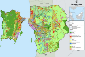
With GIS, it is possible to view land cover types and analyse their relationship to the environment. When combined with wildlife and plant survey data, managers have a more complete picture of the managed areas and could more readily assess possible environmental impacts.
Water Quality Data Management
Point sources (PS) discharge pollutants at specific locations through pipelines or sewers into the nearest drain or surface water. All parameters in such an event could be simulated using a GIS model.
Detailed Environmental Impact Assessment (DEIA)
The use of GIS in a DEIA study is to support the study in identifying and assessing the potential environmental impacts associated with the proposed project, and to determine feasible measures to avoid or reduce them.
Soil Erosion And Sedimentation Assessment
Soil erosion and sedimentation assessment and analysis are based on site survey inspections, catchment
characteristics and computer simulation with the use of GIS-based software.